An extract from Sopwith’s Map of 1835 with annotations and the Bream Heritage Walk route shown in blue in it’s approximate position.
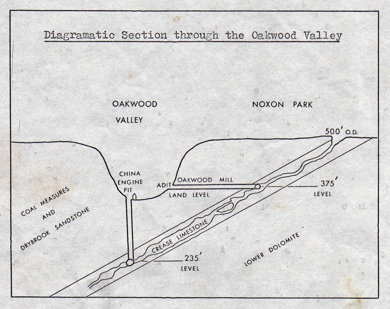
Sopwith’s Map of 1835 with annotations and Bream Heritage Walk route shown in blue. Not to scale. The yellow lines have been added to highlight the passages connected with Oakwood Mill Land Level and Oakwood Mill Deep Level.Diagramatic section through the Oakwood Valley by Ian J Standing published to accompany an article in the newsletter of the Royal Forest of Dean Caving Club – Newsletter No 26 – November 1970.
We use cookies to ensure that we give you the best experience on our website. If you continue to use this site we will assume that you are happy with it.